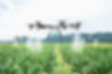
DRONATION
Provide online support for flight execution. The collected data is processed and uploaded to WebODM system and the processed image's Field 3D model is analysed for agricultural production and sustainability needs.
Check our Product intro video at PREGA in Budapest.
Erosion
While erosion is a natural geological process, human activities like deforestation, agricultural practices, and urban development can accelerate it significantly.
Erosion can lead to the loss of topsoil, reduced land fertility, sedimentation in waterways, and landscape changes.
Understanding and managing erosion is crucial, especially in contexts like agriculture and land development, to protect the soil and maintain the productiveness of our soil.


That's why we offer a 5cm resolution survey of your Fields.
You are in the PILOT seat!

Get Ready
You can use your own drone or request 1 from us.
After you provide your EASA driving license and order at a minimum rate, we will send you a DJI Phantom 4 or an Inspire 1 from our fleet - applies in Hungary only.
We will provide you online trainings on how to operate with your drone, and how to plan your flight plans.
We describe the data transfer process, and your model location. We will guide you about the model usage, and access.
We are available if you have questions at the flight and will provide check list, and Best Practices.
We will train you how to use DJI GS Pro, QGIS, and Microsoft Sharepoint.
Field Survey
You will own your flight schedule, and we will process your Field data as you upload them in our system.
We will analyse all your fields in 1-3 days from the last Field data upload.
We are using WebODM platform at our own servers, and run high precision feature detection for a perfect ortho mosaic and point cloud creation.
We review and if needed re-georeference all processed fields that your Field Surveys are perfectly align with all machinery and Satellite datasource.


Analysis
We utilise the photogrammetry process of WebODM, which generates a 3D model of your Fields
We reprocess the 3D models for relevant information in agricultural production.
We use our in house model to adjust WebODM elevation model, correct errors, and align the data with real Sea level Elevation.
We use the adjusted DSM - digital surface model - to highlight the waterlogging risk areas, 12% and 17% slope areas, Slopes and Aspects, drainage proposals to minimise flooding risk, and a freshly reviewed Field Boundary.
Your results


Pilic Kft.
HU Tolna
“Hungarian regulations of maximum slops in field blocks increased the need to understand where we can still grow row crops, and where we need to adjust our crop rotation or the AB lines we followed”
Neukum Zoltán
HU Veszprém
"Our life is around slopes and erosion. We have 17% slope and above. We were happy that we have clarity on the different slope zones and we could apply fertilisers by the regulatory directions"
Diána Tóth
HU Békés
“We are working on a new irrigation project for 75ha. We believe we need to know each cm of our Field before such a high investment.”
If you interested in the models but don't want to manage flights, connect to our resellers and distributors whom will manage the flights and provide you the processed models.
DISTRIBUTORS